Cedar Breaks & Duck Creek Area
Author: Tammy
We had a heck of a day yesterday! It was an awesome day and we were only about 30 miles from Cedar City for most of the day. We (yes, all 4 of us, including Cole) walked over 5 miles total today doing different hikes in the Cedar Breaks and Duck Creek Area.
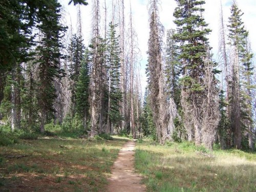
We started up Route 14, and our first hike was the Bristlecone Pine Trail. It’s a short 1/2 mile trail to an amazing overlook of Zion Canyon in the distance, and the drainage of the Virgin River. Most of the Bristlecone Pines in this forest are an average of 2000 years old, some are 4500 years old!
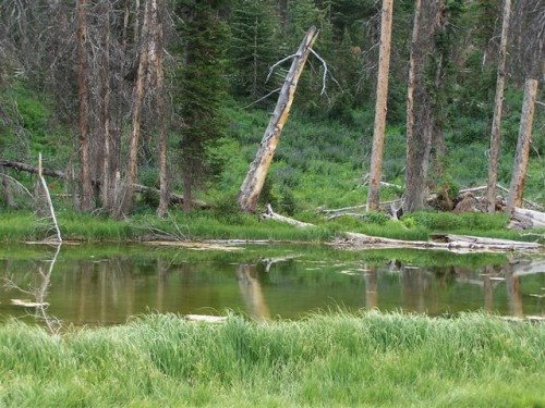
Our next stop was into Cedar Breaks National Monument to the Alpine Pond Trail. This is a 2 mile hike that is not difficult at all. There are two trails, an upper and a lower trail that when combined make the whole Alpine Pond Trail. The Upper trail is a piece of cake. The Lower Trail does have a short climb up to the beautiful Cedar Breaks Amphitheater, and a view of Brian Head Peak in the distance. At the beginning of the trail, there is a $1 trail guide that will guide you through the numbered posts along the trail. Cole, at the age of 5, had a great time looking for the numbered posts, and never complained about this hike at 10,000 feet elevation.
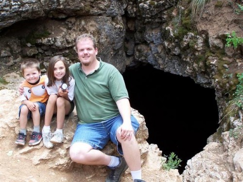
After the Alpine Pond Trail, we stopped at the Duck Creek Visitor Center to pick up some trail maps and then headed to the Ice Cave. Ice Cave is much smaller than the Mammoth Cave that we went to later, with only one chamber, but this cave has year round icicles, and ice. We climbed in the cave, and it was so cold that we could see our breath. In fact, we were standing on huge ice chunks, and saw snow inside the cave in mid-July!!! Trying to walk around the cave was like skating on ice. After cooling off in the Ice Cave, we traveled to Cascade Falls.

Cascade Falls Trail. This trail is aptly named for the water fall that flows out of the side of the cliff. The trail provides awesome views of Zion National Park and beyond. The water that flows over the falls is supplied by Navajo Lake through an underground lava tube or sink hole. The water flows a couple miles underground through the tube before exiting at the Virgin River Rim. This trail is about 3/4 miles long, but well worth the trip. We had ventured this trail, last year, with Scott’s mom and step-dad, but only made it to the overlook. There is a “Trail Closed” sign at the overlook, but the Ranger we talked to told us that we could go past the sign. He did warn us there were drop offs, fallen rocks, and some washouts so to be careful, especially with young kids. As we continued on this narrow trail, we could hear the waterfall getting closer and closer. Nothing took our breath away more than seeing this beautiful waterfall come out of nowhere from the side of a cliff! We made the trip to the waterfall and back with no problems.
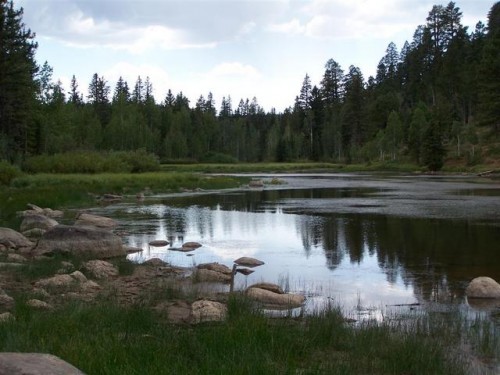
From the waterfall, we went to Aspen Mirror Lake. This is a short but scenic trail that takes you to this small mountain lake. The lake is surrounded by Aspen trees, and would make an amazing place to visit in the Autumn to see all the leaves changing colors. This lake is not very large, but it is stocked with rainbow trout for those who like to fish.
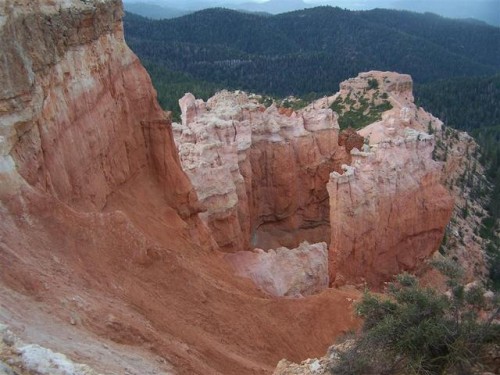
Just 9 miles from the Duck Creek Village, is the sign for Strawberry Point. We tried to find this scenic viewpoint once before, and nearly got stuck in melted-snow-turned-mud early last spring. After the initial sign at the turn for Strawberry Point, there were no other signs until we found Strawberry Ridge. Thinking that maybe Ridge and Point were the same, we tried to travel down this very rough, bumpy road in our truck. After about a mile, we decided to turn around, and continue down the main road, and within a few minutes, we did find the unmarked turnoff to Strawberry Point. This time we were able to make it to the scenic view of red rock formations and Zion National Park in the distance.
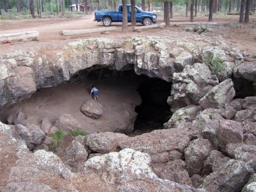
The kids love Mammoth Cave, and since we were in the area, we decided to go back to this cave. Mammoth Cave, at 8050 feet in elevation, opens to one of the largest lava tubes in Utah, with over 2200 feet of passages. Formed by cooling lava and flowing water, Mammoth Cave is part of the Markagunt Plateau. Geologists believe that some of this lava is only several thousand years old, which is relatively young in geologic terms. During summer months, the cave is a popular nightly resting spot for several bat species and is frequented by other small birds and mammals.
The Mammoth Cave looks like a big hole in the ground at first glance and is fun to explore. Take a good light for every person. The cave is pitch dark after the first turn. The exit is a small tube that allows only enough room to slide through on your belly, or if you’re small like our kids, they can duck their heads and walk / climb out the smaller tube.
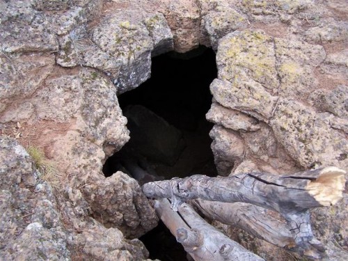
On the way back to Route 14, we decided to check out Bower Cave. We heard from the Ranger that the ladder down into the cave was broken, but still wanted to check it out to see the size. It was just a short 100 yard walk from the parking area to the cave that seems to just appear in front of you. Inside the cave there were 3 tree limbs, and we wondered if this was the broken ladder the Ranger spoke of. It seemed that even if you were able to get inside the cave, there was no way out, except to climb the slippery tree branches, so after a short stay at the cave, we hiked back to the truck, and made our trip home.
It was an exhausting day, small drops of rain cooled us on some of our hikes, and as we drove Route 14 home, we were blessed with a free truck wash, in the way of heavy rain, that cleared away all the red dust from the day. We love having so much stuff to do so close to home!!
To see all the pictures from our trip, including pictures of us with the kids, check out the following link: Click To See More Pictures!!